Invidious
Log in

12:41

Downloading Landsat 8 image from Earth Explorer - USGS

GIS Madras

Shared 2 years ago

45K views

5:44

How to Preprocess Landsat 8 Data in QGIS (2026) 📡 | Complete Step-by-Step Guide

DoITNew Lap

Shared 3 years ago

4.6K views

14:24

Calculating NDVI using QGIS and Landsat 8 Images

GeoDelta Labs  

Shared 5 years ago

67K views

3:42

How To Solve Opening Landsat 8 And 9 Error in ENVI Software

Geojay GIS Solution

Shared 7 months ago

523 views

8:27

How to Download Landsat 8 image from Earth Explorer | Free

GIS Educator

Shared 1 year ago

968 views

10:35

How To Calculate NDVI (Normalized Difference Vegetation Index) Using Landsat 8 Imagery In ArcGIS.

mosaic spatial solutions

Shared 8 months ago

278 views

4:30

How To Download Landsat 9 & Landsat 8 Level 1 & 2 Image Free!!

Explore RS & GIS Tutorials

Shared 2 years ago

1.2K views

13:01

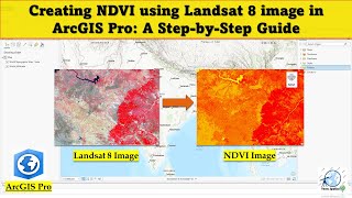
Creating NDVI Using Landsat 8 Image in ArcGIS Pro: A Step-by-Step Guide

Terra Spatial

Shared 2 years ago

10K views

8:11

GEE Tutorial: Land Cover Classification Using Landsat 8

Geo Talks

Shared 7 months ago

189 views

20:30

Supervised Classification of Landsat 8 imagery in Google Earth Engine | Part 1

Terra Spatial

Shared 3 years ago

26K views

11:03

Pan Sharpening Tutorial: Enhance Your Satellite Imagery

Prudentium

Shared 1 year ago

681 views

14:29

Landsat 8 & 9 LST in ArcGIS (Collection 2 level 1): Complete Tutorial

Sir Kwofae

Shared 4 months ago

382 views

3:59

How to do Radiometric Calibration of Landsat 8 or 9 in ENVI Software: Calibration in Remote Sensing

Geojay GIS Solution

Shared 7 months ago

723 views

7:15

How to Download Landsat 8 & Landsat 9 Satellite Data for Free | Complete Step-by-Step Guide #gis

GIS IN HINDI

Shared 3 months ago

167 views

11:11

FLAASH Atmospheric Correction of Landsat-8 Image in ENVI

RS & GIS

Shared 4 years ago

5.2K views

25:59

Calculate & Export NDVI, SAVI & NDWI Indices from Landsat 8 Imagery in Google Earth Engine

Terra Spatial

Shared 1 year ago

879 views

16:12

How to create False Color Composite Band Composite using Landsat 8 Data

TECH HIVE

Shared 2 years ago

394 views

41:54

Supervised classification in Google Earth Engine | Landsat 8 image

Terra Spatial

Shared 3 years ago

4.6K views

6:12

Cloud Removal in Landsat 8 image with Google Earth Engine | Cloud Masking

Terra Spatial

Shared 2 years ago

6K views

14:32

Cloud Masking Made Easy in Google Earth Engine | Sentinel-2 & Landsat 8 and 9

Erni Saurmalinda Butar Butar

Shared 1 year ago

839 views

11:28

Downloading Landsat 8 imagery from Earth Engine

Terra Spatial

Shared 3 years ago

22K views

7:29

Landsat 8 Band Composite in ArcMap | Clip, Add Data & Natural and False color composite Tutorial

GeoNexOra

Shared 4 months ago

48 views

6:02

Calculate NDVI | Vegetation Index using Landsat 8 in ArcGIS Pro

EARTH GISensing

Shared 2 years ago

2.1K views

10:58

QGIS Tutorials 50: Band Combinations in Landsat 8 | Change Band Combination

Terra Spatial

Shared 3 years ago

6.2K views

8:55

How to Download Landsat 8 Imagery from USGS - Latest 2021

Geotube ID

Shared 5 years ago

61K views

5:25

Download Landsat Images from Google Earth Engine (Landsat 4, 5, 7, 8, 9)

GIS with Raja Usama

Shared 1 year ago

2.6K views

7:31

How to calculate and solve NDVI and NDWI in QGIS using Landsat 8/7 Data!!

Swayan

Shared 5 months ago

461 views

13:02

Mastering Landsat 8 Data: Creating Band Composite & Band Combinations in ArcGIS Pro

Terra Spatial

Shared 2 years ago

6.1K views

8:35

MNDWI in ArcGIS: How to Map Water Bodies Using Landsat 8 & 9

Sir Kwofae

Shared 3 months ago

221 views

15:09

NDVI Change Detection Analysis using Landsat 8 | Google Earth Engine

Terra Spatial

Shared 3 years ago

7K views

16:25

How to extract lake or water body from Landsat 8 | unsupervised classification arcgis

GIS with Raja Usama

Shared 2 years ago

2.6K views

1:04

Landsat-8 Thermal Infrared Sensor (TIRS) Vicarious Radiometric Calibration | RTCL.TV

STEM RTCL TV

Shared 2 years ago

7 views

13:45

How to do EVI & NDVI Calculation from #Landsat8, ; More refined & accurate method in #Qgis

Explore RS & GIS Tutorials

Shared 5 years ago

7K views

13:26

How to Calculate NDVI Using Landsat 8 in Google Earth Engine

Satellite Remote Sensing and GIS

Shared 1 year ago

288 views

6:11

How to Download Landsat 8/9 Data (Including Panchromatic Band) from USGS EarthExplorer

Mihir Dias

Shared 1 year ago

1.1K views

1:53

How to add Landsat 8 or 9 images to ENVI software using the MTL file Geotif with Metadata

Geojay GIS Solution

Shared 7 months ago

748 views

Source code Documentation
Released under the AGPLv3 on GitHub. View JavaScript license information. View privacy policy.
Donate Current version: 2.20260804.1- @ master ( 2.20260804.1 )